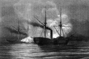
Photo: USS Hatteras (1861-1863) in action with CSS Alabama, off Galveston, Texas, on 11 January 1863. Lithographed by A. Hoen & Co., Baltimore, Md. Hatteras was sunk in this engagement. U.S. Naval Historical Center Photograph.
By Douglas Main
OurAmazingPlanet
updated 1/14/2013 12:19:59 PM ET
USS Hatteras sank in Gulf of Mexico 150 years ago after battle with CSS Alabama
On Jan. 11, 1863, a Union warship was sunk in a skirmish with a Confederate vessel in the Gulf of Mexico.
Exactly 150 years later, a new 3-D map of the USS Hatteras has been released that shows what the remains of the warship look like. The Hatteras rests on the ocean floor about 20 miles (32 kilometers) off Galveston, Texas, according to a release from the National Oceanographic and Atmospheric Administration, which helped to sponsor the expedition to map the shipwreck . . . Read Complete Report


Leave a Reply